Manchester Region
.
A thematic map compilation - a working 'Atlas of the peri-urban' is available here
(preliminary work in progress)

(these pages under construction)
(for tables see the full Manchester region framework
The Manchester 'wider' region is centred on the UK's second city, a hub of investment and innovation, and a global destination for culture sport and science. It is also a sink of deprivation, low productivity, poor health and housing.
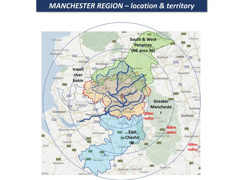
Greater Manchester is at the centre of the region, home to 2.7 million people with an area of 1,277 km2. Peri-cene case study then looks at a wider hinterland of between 40-60km radius, a combined social-economic-ecological region, with many overlapping boundaries:
The spatial mapping in the Manchester region framework shows something of the complexity of the geography and its dynamic changes. So the Peri-cene has focused on two main zones of interest: an inner urban fringe with flood risk problems, and an outer hinterland with combined issues of climate change and peri-urbanization. Each has several overlapping units and boundaries, as on the map below:
Overall, this wider region has a relatively mature system of spatial planning and governance for a largely urbanised population with medium growth. However, there are major issues with housing pressures, economic and social segregation, urban-rural disconnections, fragmented climate-environment governance, and an uncertain policy context in the context of Brexit.
.
A thematic map compilation - a working 'Atlas of the peri-urban' is available here
(preliminary work in progress)